Land Clearing Company services in Central Ohio start with knowing Brookston-Crosby clays in Franklin County, karst in Powell, and the 32–36 inch frost line that affects stump removal and grading. Fortress Level Construction, based in Westerville since 2009, answers fast at (844) 656-0129 for code-compliant clearing across local counties.
Quick Facts — Land Clearing Company
Why ‘Land Clearing Company’ Matters in Central Ohio
Choosing a Land Clearing Company in Central Ohio is different from other regions because of the way glacial till, heavy clays, and karst pockets shape both equipment choices and erosion control. In Franklin County’s Brookston–Crosby clay series, saturated spring soils from Columbus to Upper Arlington demand low-ground-pressure track machines and Ohio EPA-compliant silt controls along the Scioto and Olentangy watersheds. In neighborhoods like German Village or Bexley with tight lots and historic overlays, work sequencing must satisfy City of Columbus inspectors and neighbor access constraints common to older urban blocks.
North of Westerville in Delaware County, the limestone bedrock and karst risk in Powell and Liberty Township change how you handle tree removal and grubbing: trenching or deep stump extraction can open voids if you ignore subsurface features. East toward Sunbury and Galena, clay loams are more forgiving but HOA restrictions around Olentangy Schools subdivisions often limit work hours and require temporary fencing. Fortress Level Construction tailors approaches by county and even by watershed, coordinating with Delaware County Soil & Water on best management practices for rapidly developing corridors.
Moving east, Licking County brings long rural drives from Westerville past New Albany’s Intel-area traffic toward Johnstown, Granville, and Newark Earthworks. Parcels from 30 to 180 acres near Hebron or Buckeye Lake can lack municipal sewer, so clearing plans must preserve swales and soils suitable for on-lot septic per Licking County Health Department rules. South in Fairfield County, the Hocking River floodplain around Lancaster and Baltimore dictates floodplain permits and elevated erosion controls, while steep sandstone and shale transitions near Amanda and the Hocking Hills gateway require line-of-sight planning for safe felling. West-northwest in Union County from Marysville to Plain City, deep, fertile glacial till soils are prime farmland; clearing here often intersects agricultural preservation easements, so the work must align with Union County and township comprehensive plans. Learn more by county: Franklin (Land Clearing Franklin County Ohio), Delaware (Land Clearing Delaware County Ohio), Licking (Land Clearing Licking County Ohio), Fairfield (Land Clearing Fairfield County Ohio), and Union (Land Clearing Union County Ohio).
What Land Clearing Company Services Include
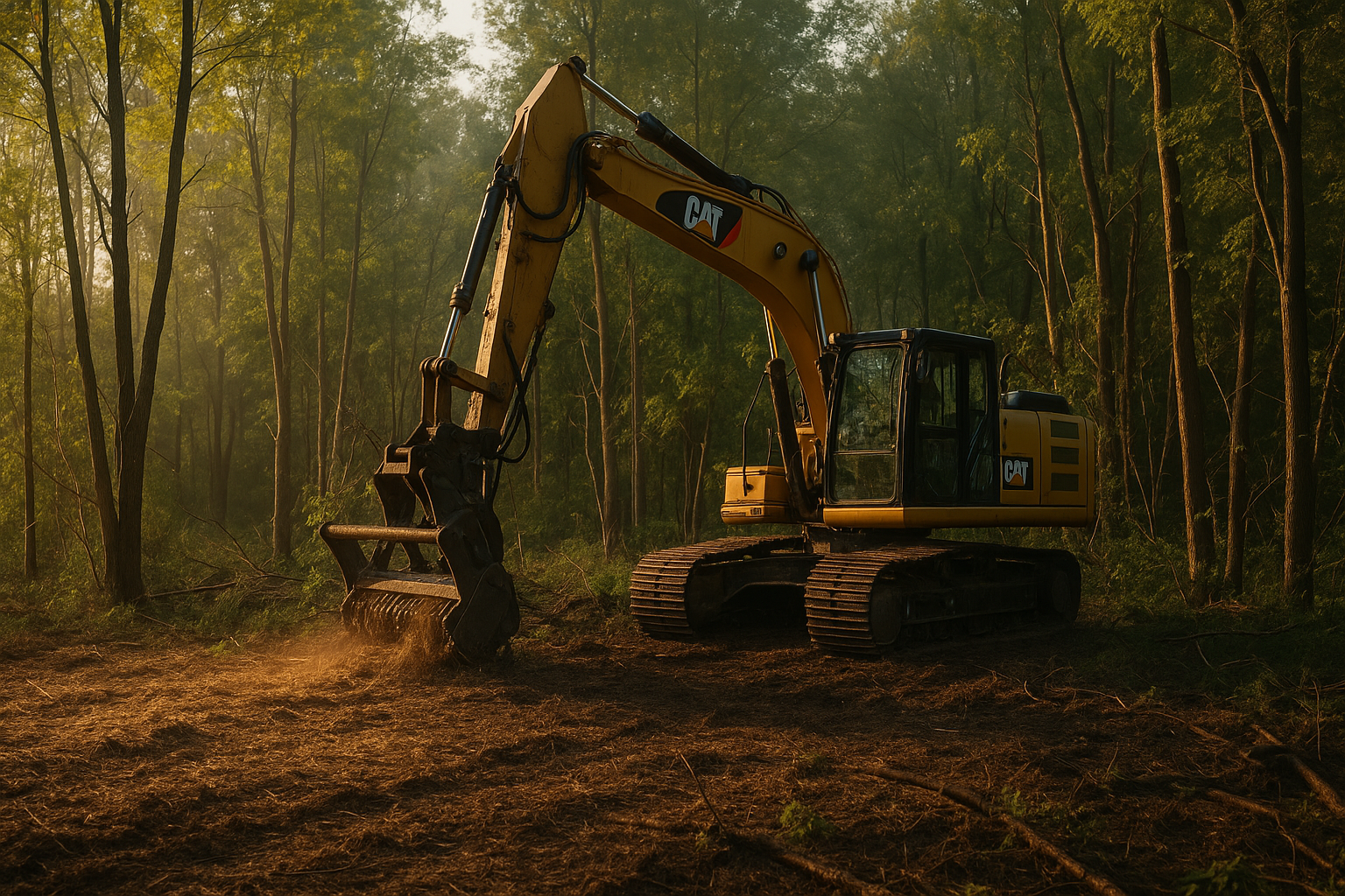
- Forestry mulching suited to Ohio timber: Fortress Level Construction uses high-flow mulchers to shred brush and saplings common along Alum Creek in Westerville and Big Walnut Creek near Gahanna. Chips are spread for erosion control per Ohio EPA guidance. See /forestry-mulching-central-ohio/.
- Selective tree clearing with Ohio utility coordination: From Worthington to Hilliard, selective felling navigates overhead AEP lines and Columbia Gas corridors; call 811 statewide before any digging. Crews manage hardwoods like Ohio maple and oak prevalent in Franklin and Delaware counties.
- Full clearing, grubbing, and root rake work on glacial tills: In Columbus and Grove City, Brookston-Crosby clays hold roots tightly. Fortress Level Construction’s rakes and dozers remove stumps to depths mindful of the 32–36 inch frost line adopted in Central Ohio, aiding stable backfill.
- Karst-aware clearing in Powell/Liberty Township: East-west Delaware County shifts from karst to clay loam. In Powell, Fortress Level Construction minimizes deep grubbing and uses geotextile stabilization where limestone voids are suspected, coordinating with Delaware County engineers for site safety.
- Brush hogging and rough-cut mowing in floodplains: Along the Hocking River near Lancaster and in Buckeye Lake’s fringe marsh, seasonal mowing meets Fairfield and Licking County floodplain restrictions. Fortress Level Construction times work during drier Ohio windows to protect soils.
- Lot clearing for infill builds in Columbus and Grandview Heights: Alley access and tight setbacks require compact excavators and material staging that match City of Columbus Right-of-Way rules. Urban lots near the Arena District demand after-hours trucking plans around event schedules.
- Stump grinding and on-site material reuse: In Gahanna and New Albany, stump chips can be repurposed as temporary paths or berms, reducing Franklin County tipping fees. Where homeowners in Reynoldsburg or Whitehall need sod-ready finishes, chips are hauled and topsoil from local pits is imported.
- Access road cuts and matting over Ohio clays: Licking County’s heavy clay lowlands near Hebron need timber mats to prevent rutting under spring thaw. Fortress Level Construction installs temporary access roads that meet Ohio EPA CGP perimeter control requirements.
- Sediment, erosion, and SWPPP implementation: For projects over 1 acre in Columbus, Newark, and Marysville, Ohio EPA NPDES coverage and a SWPPP are standard. Silt fence, inlet protection, and construction entrances match county SWCD details.
- Site preparation and rough grading across Central Ohio: From Dublin’s Scioto tributary lots to Plain City’s agricultural edge, grading plans direct runoff to approved outlets, balancing Ohio rain patterns (~38–40 inches annually) with infiltration in glacial till soils. See /site-preparation-central-ohio/.
- Driveway and culvert installation to county specs: Access points on Union County rural roads or Delaware County arterials must meet county engineer culvert sizing; Fortress Level Construction installs ODOT-spec aggregates for stable approaches. See /driveway-construction-central-ohio/.
- Pond and drainage swales per local watershed needs: In Fairfield County’s sandstone transition zones and Union County’s level fields, pond sites must consider watershed acreage and outlet permits. Explore /pond-digging-central-ohio/.
- Debris hauling with local disposal options: Wood from Westerville, Pickerington, and Canal Winchester jobs can route to Central Ohio mulch yards; construction debris follows Franklin County and Fairfield County landfill rules, which affects cost and scheduling.
- Habitat and trail clearing near Ohio landmarks: Boardwalk and trail corridors around Dawes Arboretum in Licking County or along the Scioto Mile require minimal-disturbance methods and seasonal timing to protect habitat under ODNR guidance.
How Close Is the Nearest Fortress Level Crew?
Fortress Level Construction is based in Westerville, so drive times to Central Ohio county seats are practical for same-week starts after permits. Downtown Columbus (Franklin County) is 10–25 minutes via I‑270 depending on traffic near OSU and the Arena District. Delaware (Delaware County) averages 20–30 minutes up US‑23, with Powell and Lewis Center along the way. Newark (Licking County) typically runs 35–45 minutes via OH‑161 past New Albany’s Intel corridor and Johnstown. Lancaster (Fairfield County) is 40–50 minutes down US‑33, accounting for Hocking River work zones. Marysville (Union County) is 30–40 minutes via US‑33 past Plain City. Cities covered across these corridors include Columbus, Westerville, Dublin, Hilliard, Grove City, Gahanna, Upper Arlington, Reynoldsburg, Whitehall, Worthington, Bexley, Groveport, New Albany, Grandview Heights; Delaware, Powell, Lewis Center, Sunbury, Galena; Newark, Heath, Pataskala, Granville, Johnstown, Hebron, Buckeye Lake; Lancaster, Pickerington, Canal Winchester, Baltimore, Amanda; and Marysville, Plain City, Richwood.
What Does Land Clearing Company Cost in Central Ohio?
Costs in Central Ohio reflect terrain, access, and regulations unique to Franklin, Delaware, Licking, Fairfield, and Union counties. Forestry mulching of light brush in Union County’s level glacial till might range $2,200–$3,200 per acre, while denser thickets near the Scioto River in Dublin or Grove City can push to $3,500–$4,500 per acre due to heavier hardwood understory. Infill lot clearing in Columbus or Grandview Heights, often 0.15–0.25 acres with alley access, typically runs $3,500–$8,500 depending on tree count, tight trucking windows near the Short North, and City of Columbus ROW constraints. Full clearing and grubbing with stump removal and haul-off across Franklin and Licking counties often ranges $6,000–$12,000 per acre, with higher pricing on sandstone ridges around Amanda in Fairfield County where rock slows extraction, or karst-prone Powell sites where shallow bedrock discourages deep grub-out. SWPPP preparation for Ohio EPA NPDES coverage may add $1,000–$2,500, while erosion and sediment controls (construction entrances, silt fence, inlet protection) can add $1,500–$5,000, sized per county SWCD details. Seasonal moisture in Brookston–Crosby clays means spring work can cost more due to matting and haul road stabilization; summer-fall windows around Central Ohio fairs and school calendars can reduce costs through better ground conditions and lighter traffic. Disposal also varies: hauling to Franklin County facilities or diverting clean wood to Central Ohio mulch processors reduces tipping fees compared to mixed debris. Where feasible in Delaware or Union counties, on-site chipping and windrowing lowers export volumes. Below is a high-level comparison that reflects typical ranges for Central Ohio; specific quotes are refined after an on-site walk in Westerville, Dublin, Powell, Newark, Lancaster, or Marysville.
| Service Type (Central Ohio) | Typical Range | County/Condition Notes |
|---|---|---|
| Forestry Mulching (light–moderate brush) | $2,200–$4,500 per acre | Lower in Union County till; higher in Franklin riverside thickets (Scioto/Olentangy) |
| Urban Lot Clearing (0.15–0.25 ac) | $3,500–$8,500 per lot | Columbus/Grandview: alley access, ROW and parking constraints near OSU and Arena District |
| Full Clearing + Grubbing + Haul-off | $6,000–$12,000 per acre | Higher on Fairfield sandstone ridges (Amanda/Hocking Hills gateway); adjust for karst in Powell |
| SWPPP + NPDES (Ohio EPA) | $1,000–$2,500 | Required ≥1 acre disturbed; Columbus MS4 adds checklists; coordinate with county SWCD |
| Erosion & Sediment Controls | $1,500–$5,000 | Construction entrances, silt fence, inlet protection per ODOT/Ohio EPA specs |
| Stump Grinding (select trees) | $35–$85 per inch DBH | Access near New Albany/Westerville drives cost; deeper grind in 32–36 in frost zones |
| Access Road/Matting (wet clays) | $1.50–$3.50 per sq ft | Common in Licking County lowlands near Hebron/Buckeye Lake during spring thaw |
Expect pricing to reflect county-specific reviews: Franklin County floodplain permits along the Scioto, Delaware HOA landscaping covenants near Liberty High School, Licking’s Intel-area traffic scheduling on OH‑161, Fairfield’s Hocking River setbacks, and Union County agricultural easements around Marysville and Richwood.
Ohio Regulations for Land Clearing Company
Central Ohio requirements start with the Ohio EPA Construction General Permit for stormwater. If your project in Columbus, Dublin, or Newark disturbs 1 acre or more, you’ll need NPDES coverage and a SWPPP that addresses sediment basins, construction entrances, and phasing. Many cities in Franklin County, including Columbus, operate as MS4 communities with their own plan notes and preconstruction meeting expectations, especially near the Scioto Mile and Olentangy corridor.
Franklin County: Urban lot clearing in Columbus, Bexley, or Upper Arlington can trigger tree preservation or replacement conditions during larger subdivisions or commercial redevelopments, and floodplain development permits are common along Big Walnut Creek and the Scioto. City right-of-way access for roll-offs or wood hauling requires permits when staging on streets near Ohio State University or downtown districts.
Delaware County: Karst-awareness is embedded in engineering reviews in Powell and Liberty Township. Clearing that implies deep grubbing may be limited or conditioned, and HOA covenants in fast-growing subdivisions around Lewis Center and Galena influence tree lines and screening. Delaware County Soil & Water Conservation District reviews erosion controls for subdivisions feeding the Olentangy River basin.
Licking County: With Intel-related construction traffic around New Albany and Johnstown, lane restrictions along OH‑161 affect haul routes and timing. Rural parcels near Granville, Heath, and Buckeye Lake often need coordination with the Licking County Engineer for driveway permits and with the Health Department for septic-protective clearing limits. Wetland screening is frequent along lowland clays; isolated wetlands may require Ohio EPA permitting alongside USACE Section 404/401 review.
Fairfield County: The Hocking River floodplain and tributaries in Lancaster, Baltimore, and Amanda bring flood-damage prevention reviews, with setbacks that limit clearing to avoid increased flood risk. Slopes in the sandstone/shale transition need specific erosion controls per Fairfield County and ODOT specs, including temporary seeding and matting on steeper grades common near the Hocking Hills gateway.
Union County: Many Marysville and Plain City areas include agricultural preservation easements or drainage tiles in prime glacial till soils. Clearing must maintain tile outlets and documented field swales; driveway approaches require Union County Engineer permits. Projects ≥1 acre need Ohio EPA NPDES coverage, and rural burns are regulated by Ohio Administrative Code open burning rules, which are stricter near incorporated areas.
Across Central Ohio, utilities must be located via the Ohio 811 system before stump extraction or trenching. Tree work around AEP and municipal power lines in Worthington, Whitehall, and Groveport invoke utility clearance standards, and ODNR guidance can limit timing near designated wildlife areas, such as Big Darby Creek in western Franklin and Union counties.
Our Land Clearing Company Process — What to Expect
On-Site Walk in Westerville and Nearby Cities
Fortress Level Construction meets you on the property in Westerville, Columbus, or Dublin to flag tree lines, wetlands, and access paths. They assess Brookston–Crosby clays, glacial till, or karst indicators to shape machine selection and Ohio EPA erosion measures for Franklin and Delaware counties.
Utility Locates and Local Permits
Before grubbing near Gahanna, Powell, or Pataskala, Ohio 811 marks gas, electric, and fiber. If the site lies in the Scioto or Hocking River floodplain, floodplain permits are secured with Franklin or Fairfield County. Projects over 1 acre get NPDES coverage and a SWPPP fitting Central Ohio rainfall patterns.
Access Setup and E&S Controls
In Licking County lowlands around Hebron or Buckeye Lake, timber mats and #57 stone construction entrances prevent rutting. Silt fence and inlet protection align with county SWCD details to keep sediment out of the Olentangy, Big Walnut, or Walnut Creek watersheds.
Clearing, Mulching, and Felling
Tracked mulchers handle brush common from Grove City to Whitehall, while hand-fell crews manage urban lots in Grandview Heights with alley-only access. Karst-prone Powell sites get shallow stump tactics to avoid voids. Logs are decked for local mills or sent to Central Ohio mulch processors.
Stumps, Grubbing, and Backfill
In Columbus and Worthington, stumps are excavated mindful of the 32–36 inch frost line so backfill settles before winter freeze-thaw. On Fairfield sandstone near Amanda, rock hammers may be needed; in Union County till, rakes and dozers finish quickly with minimal import.
Final Grading and Stabilization
Contours direct runoff to approved outlets in Pickerington and Canal Winchester, protecting storm inlets. Temporary seed (ODOT 659) and straw stabilize soils, with options for Ohio fescue/bluegrass mixes. SWPPP closeout photos document compliance for Columbus, Delaware, Newark, Lancaster, or Marysville inspectors.
Why Central Ohio Property Owners Choose Fortress Level
Local familiarity matters when the Scioto floods, OH‑161 clogs with Intel traffic, or a Powell yard hides limestone. Fortress Level Construction has operated from Westerville since 2009, using Ohio-appropriate equipment: low-ground-pressure track loaders for Franklin County clays, mulchers built for hardwood understory along the Olentangy, and rakes that avoid opening karst around Liberty Township. Crews schedule around OSU game days and downtown events, which keeps trucking predictable through Columbus and Grandview Heights.
The team is owner-operated by Lee C., who grew projects from backyard brush work near Hoover Reservoir to 180-acre field conversions outside Marysville. They integrate Ohio EPA NPDES paperwork with practical site controls, coordinate with Delaware County SWCD on growing subdivisions near Lewis Center, and handle floodplain nuances along the Hocking River in Fairfield County. The result is clearing that fits Central Ohio soils, codes, and travel realities rather than a generic approach.
Is Fortress Level the Right Fit?
If you manage a 30–180 acre farm on glacial till outside Marysville or Richwood in Union County, Fortress Level Construction turns fencerow thickets into field-ready edges while protecting drainage tiles—key for prime till soils. Builders and realtors prepping infill lots in Columbus, Bexley, or Worthington get alley-smart clearing that respects City of Columbus right-of-way rules and neighbors, with compact equipment that fits older streets near OSU and the Short North.
Hunters and habitat groups in Licking and Fairfield counties benefit from selective mulching to shape travel corridors on sandstone ridges near Amanda or along Buckeye Lake fringe marshes. For homeowners in Powell, Lewis Center, and Sunbury, the team balances HOA covenants with karst-aware clearing and erosion controls that satisfy Delaware County plan reviewers. Whether your site sits near the Scioto Mile, Dawes Arboretum, or the Little Brown Jug grounds in Delaware, the plan is tuned to Ohio’s soils, slopes, and permitting.
What Central Ohio Clients Say
“We cleared 12 wooded acres off Green Chapel Road between Johnstown and New Albany during the early Intel rush. Fortress Level Construction staged around OH‑161 lane closures and wet Licking County clay, installed stone entrances to Ohio EPA specs, and finished grading for our future pole barn.” — Mark R., Johnstown, Licking County
“On our Powell lot near Liberty Township, karst probing showed shallow limestone. The crew avoided deep grubbing, mulched the understory, and compacted backfill carefully. They worked within our HOA time limits and coordinated with Delaware County SWCD. The yard drains better, and our builder in Lewis Center is thrilled.” — Alisha K., Powell, Delaware County
“Our Hilliard teardown had alley-only access close to Upper Arlington. Fortress Level Construction used a compact excavator, timed trucking around OSU game traffic, and kept silt out of the nearby Olentangy basin. Columbus inspectors signed off without punch lists, and we were pad-ready for framing.” — Bryan S., Hilliard, Franklin County
Areas We Serve
Franklin County
Pop: 1,323,807 | 10-25 min from Westerville
Delaware County
Pop: 214,124 | 15-35 min from Westerville
Licking County
Pop: 180,564 | 25-45 min from Westerville
Fairfield County
Pop: 161,551 | 30-50 min from Westerville
Union County
Pop: 61,578 | 25-40 min from Westerville
Frequently Asked Questions About Land Clearing Company
Related Articles — Land Clearing Company in Central Ohio
Get Your Free Land Clearing Company Estimate Today
Fortress Level Construction handles residential lots, commercial parcels, farm acreage, and everything in between across Central Ohio’s 5-county service area.
Fast Turnaround | Local Westerville Crew | Written Estimates, No Surprises