Farm Land Clearing in Central Ohio requires solutions tuned to Brookston-Crosby clays, glacial till, and county rules from Franklin to Union. Fortress Level Construction, based in Westerville since 2009, clears fields and fence rows across the Columbus metro and surrounding farms. Call (844) 656-0129 for an on-site walk in Ohio’s soil and weather realities.
Quick Facts — Farm Land Clearing
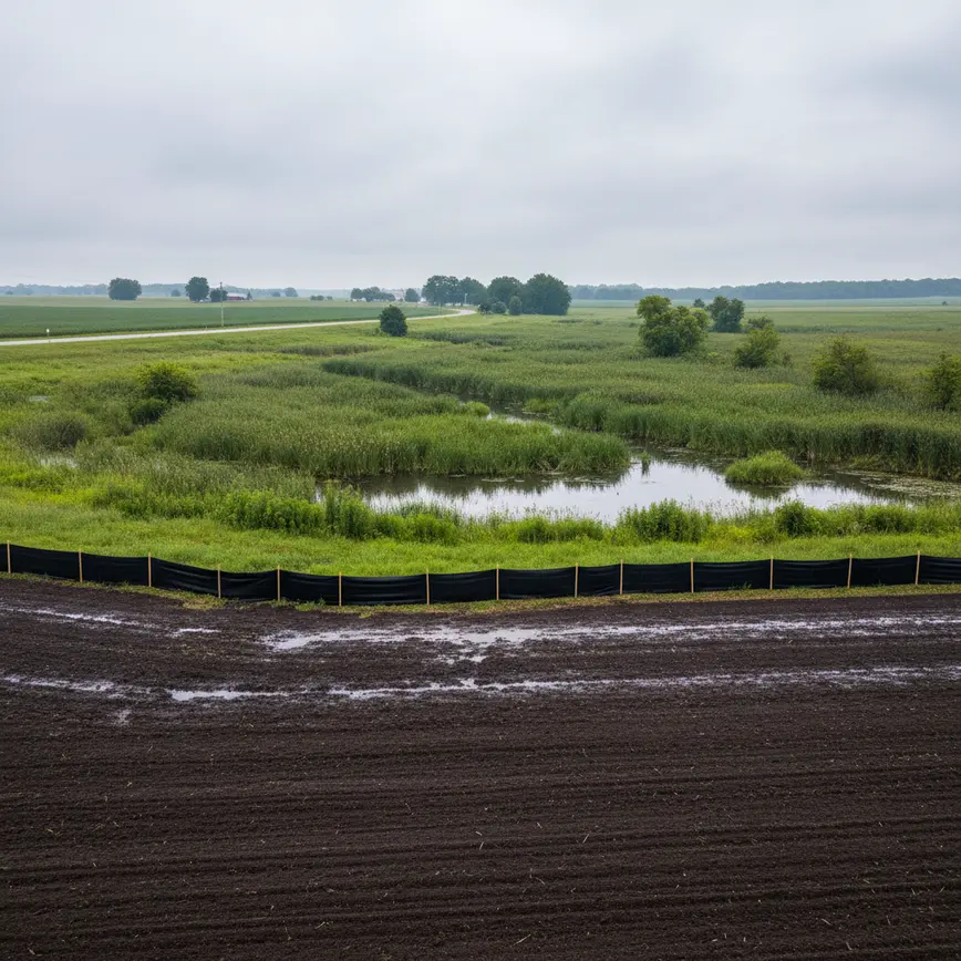
Why ‘Farm Land Clearing’ Matters in Central Ohio
Across Franklin, Delaware, Licking, Fairfield, and Union counties, farm productivity hinges on how well you handle Ohio’s glacial soils and seasonal moisture. In Franklin County (population 1,323,807), Brookston-Crosby clay over glacial till holds water along the Scioto and Olentangy corridors from Columbus to Worthington, so fence row clearing and grubbing have to be paired with drainage planning that fits the City of Columbus stormwater manual and the county’s Erosion & Sediment Control expectations. In Delaware County (population 214,124), the karst limestone west of Powell and Liberty Township introduces sinkhole risk that changes the clearing method compared with the clay loams along the US‑36/SR‑37 corridor near Delaware City.
When you cross into Licking County (population 180,564), the lowland heavy clays around Newark, Heath, and Johnstown behave differently than the sandstone ridges east of Granville toward Hanover. Recent Intel construction activity near New Albany and Johnstown has increased SR‑161 traffic, which affects mobilization for clearing around Pataskala and Etna and may influence you to stage work earlier in the day. In Fairfield County (population 161,551), the Hocking River floodplain and the shale/sandstone transition zone around Lancaster and Amanda can require limited-access equipment and seasonal timing to stay within floodplain restrictions. Union County (population 61,578) features deep, productive glacial till and prime farmland soils around Marysville and Plain City where large-parcel (50–180 acres) clearing is common, but agricultural preservation easements can limit tree removal and dictate fence row realignments.
Fortress Level Construction operates from Westerville, just off I‑270 and OH‑3, placing crews within 10–25 minutes of Columbus in Franklin County and within 15–35 minutes of Delaware City in Delaware County, with straightforward access to OH‑161 for Newark in Licking County (25–45 minutes), US‑33 for Lancaster in Fairfield County (30–50 minutes), and US‑33/US‑42 for Marysville in Union County (25–40 minutes). The team understands that Ohio’s frost line, typically 32 inches in Central Ohio, matters for stump removal, subsoiling, and culvert depths on farm lanes. Explore county-specific details here: Franklin County (/farm-land-clearing-franklin-county-ohio/), Delaware County (/farm-land-clearing-delaware-county-ohio/), Licking County (/farm-land-clearing-licking-county-ohio/), Fairfield County (/farm-land-clearing-fairfield-county-ohio/), and Union County (/farm-land-clearing-union-county-ohio/).
What Farm Land Clearing Services Include
- Forestry mulching tailored for Ohio clays and glacial till: Shred honeysuckle and saplings along the Olentangy and Big Walnut corridors without disturbing saturated Brookston-Crosby subsoils in Franklin County. Learn more: Forestry Mulching Central Ohio
- Brush and fence row clearing for row-crop efficiency: Open up long-neglected hedgerows in Union County near Plain City and Richwood while protecting prime till soils. Service hub: Fence Row Clearing Central Ohio
- Tree removal and stump grubbing to 32″ frost depth: In Delaware County’s clay loam east of I‑71, stump extraction and backfill meet Ohio’s frost line expectations to prevent future settling. See: Tree Removal Central Ohio
- Field leveling and excavation on Ohio glacial till: Subgrade work for hay fields near Grove City and Hilliard uses dozers and GPS blades suited to Columbus-area compaction tendencies. Details: Excavation Central Ohio
- Farm lane and access road construction: Build durable gravel lanes off OH‑37 near Sunbury or OH‑38 near Milford Center with culverts set below Ohio’s frost line and sized to Franklin/Delaware stormwater criteria. Visit: Access Road Construction Central Ohio
- Drainage and tiling coordination: Coordinate clearing with 4″–8″ tile laterals near Pickerington and Baltimore in Fairfield County, accounting for Hocking River floodplain discharge. More: Drainage And Tiling Central Ohio
- Pasture reclamation around the Scioto and Olentangy: Clear volunteer trees near Upper Arlington and Worthington while following City of Columbus riparian setback guidance. See: /land-clearing-central-ohio/
- Pond site clearing and edge management: Prep pond embankments near Buckeye Lake, Hebron, and Millersport with sediment controls that match Licking County Soil & Water Conservation District standards. Hub: Pond Excavation Central Ohio
- Debris management and hauling under Ohio rules: From Whitehall to Reynoldsburg, manage wood waste with Ohio EPA-compliant options, including chipping or hauling to approved facilities. Learn: Site Prep Central Ohio
- Stump grinding and surface restoration: In Gahanna and New Albany subdivisions with HOA rules, grind stumps and restore turf per neighborhood covenants while observing municipal right-of-way limits. See: Stump Grinding Central Ohio
How Close Is the Nearest Fortress Level Crew?
From Westerville—just east of I‑71 and north of I‑270—Fortress Level Construction stages equipment to reach county seats quickly on Central Ohio routes farmers actually use. Typical drive times: Columbus (Franklin County) via I‑270/US‑23: 10–25 minutes; Delaware (Delaware County) via US‑23/OH‑315: 15–35 minutes; Newark (Licking County) via OH‑161: 25–45 minutes; Lancaster (Fairfield County) via US‑33: 30–50 minutes; and Marysville (Union County) via US‑33/US‑42: 25–40 minutes. That proximity means morning mobilization to fencerows in Dublin, Powell, or Pataskala before soils warm, and same-day returns for late-afternoon work in Grove City, Canal Winchester, or Plain City.
What Does Farm Land Clearing Cost in Central Ohio?
Pricing in Central Ohio depends on your county’s soils, access, and tree mix. Forestry mulching in Franklin County’s Brookston-Crosby clays near Galloway may run $1,800–$3,200 per acre, while full clearing with stump grubbing for hardwood stands in Union County north of Marysville can trend $6,500–$12,500 per acre due to glacial till rootballs. In the karst-prone belt of western Delaware County around Powell and Liberty Township, sinkhole risk assessments and low-ground-pressure equipment can add $400–$1,200 per acre to reduce compaction and avoid subsurface voids. Licking County parcels near Johnstown and New Albany may require off-peak mobilization because of Intel-related traffic along SR‑161, potentially adding a modest logistics fee. Fairfield County floodplain tracts south of Lithopolis toward Amanda can need seasonal timing to avoid Hocking River restrictions, which can spread work across cooler months and reduce per-day production. Expect stump-grinding-only projects in suburban Gahanna, Upper Arlington, or Bexley to be priced per stump ($75–$450) based on diameter and proximity to utilities flagged by Ohio 811.
| County & Typical Terrain | Method | Typical Price (per acre) | Ohio-Specific Notes |
|---|---|---|---|
| Franklin (Brookston-Crosby clays from Grove City to Worthington) | Forestry mulching + spot grubbing | $1,800–$3,200 | Spring saturation slows production; follow Columbus stormwater BMPs near Scioto/Olentangy. |
| Delaware (karst west of Powell; clay loam east toward Sunbury) | Select clearing + low-ground-pressure mulching | $2,400–$4,200 | Karst evaluation near Liberty Township; HOA rules in Orange Township add access constraints. |
| Licking (heavy clays Newark/Heath; ridges near Granville/Hanover) | Full clearing + erosion controls | $2,800–$5,600 | SR‑161/Intel traffic influences mobilization; wetlands around Raccoon Creek require USACE review. |
| Fairfield (Hocking floodplain, shale/sandstone near Amanda) | Dozer/excavator clearing + seasonal timing | $2,500–$5,000 | Floodplain permits near Hocking River; steep slopes southeast of Lancaster slow production. |
| Union (deep glacial till near Marysville/Plain City) | Full clearing + grubbing + lane build | $3,500–$7,500 | Large 50–180 acre tracts; agricultural easements may restrict tree removal. |
Other Ohio-specific costs: debris hauling to approved facilities in Franklin/Delaware ($300–$700 per load), on-site chipping in Pataskala or Etna (included or +$150/acre), NPDES erosion controls when disturbing 1+ acre in Columbus or Lancaster ($1,200–$3,800 for silt fence, tracking pads, inlet protection), and winter-rate discounts when frost stabilizes access in Westerville and Dublin. Request a field walk anywhere from New Albany to Marysville to refine acre-by-acre pricing based on your soils and access.
Ohio Regulations for Farm Land Clearing
Ohio’s regulatory landscape shapes how quickly you can clear fields from Columbus to Marysville. If your clearing in Franklin County (Columbus, Grandview Heights, Upper Arlington) disturbs 1 acre or more, the Ohio EPA Construction General Permit (CGP) and NPDES requirements apply, and the City of Columbus requires an Erosion & Sediment Control plan under local stormwater rules. Riparian setbacks along the Scioto, Olentangy, and Big Walnut may affect clearing widths near Groveport, Gahanna, and Worthington.
In Delaware County (Delaware City, Powell, Lewis Center, Sunbury), county and township zoning can influence tree removal, particularly within HOAs in Orange Township and along the Olentangy River corridor. West of Powell, karst limestone calls for caution when grubbing trees to avoid subsurface collapse; some projects request a geotechnical letter before heavy clearing. The Delaware County Engineer may review driveway culverts for farm lanes tying into county roads like US‑23 or OH‑315.
Licking County (Newark, Heath, Pataskala, Granville, Johnstown) has active development pressure around New Albany/Johnstown because of the Intel site. The Licking County Planning Commission and Soil & Water Conservation District often coordinate on erosion controls; any wetland or stream impacts along Raccoon Creek or the South Fork Licking River can require USACE Huntington District authorization (Section 404) and Ohio EPA 401 certification. Road-use coordination along OH‑161 or OH‑310 may be requested during heavy haul periods.
Fairfield County (Lancaster, Pickerington, Canal Winchester) includes mapped floodplains along the Hocking River and Walnut Creek. Clearing inside FEMA floodplains near Baltimore, Amanda, or Lithopolis can require floodplain development permits, and Fairfield Soil & Water may ask for stabilized construction entrances to limit sediment tracking to US‑33. Steep shale and sandstone slopes southeast of Lancaster often trigger additional erosion BMPs.
Union County (Marysville, Plain City, Richwood) often sees large 50–180 acre agricultural clearings. Agricultural preservation easements recorded with the county can limit tree removal and prescribe vegetative buffers along tributaries of Mill Creek and Big Darby Creek. Farm lanes connecting to US‑42 or OH‑31 may need culvert sizing per the Union County Engineer. Regardless of county, Ohio 811 utility marking is required before stump grinding or excavation near Westerville, Dublin, Reynoldsburg, or Canal Winchester.
Local tree ordinances vary: within the City of Columbus and suburbs like Bexley and Upper Arlington, right-of-way trees fall under municipal control; work near historic overlays—German Village and Victorian Village in Columbus or the Granville Historic District—may require preservation review even for private parcels bordering those districts.
Our Farm Land Clearing Process — What to Expect
On-site Walk in Your County
From Westerville, a crew meets you on the parcel—whether it’s a 30-acre pasture in Ostrander (Delaware County) or a 90-acre woodlot near Etna (Licking County). They probe Brookston-Crosby clays, check for karst indicators west of Powell, and flag riparian setbacks along streams feeding the Scioto or Hocking.
Utility, Access, and Seasonal Plan
Ohio 811 locates utilities in suburbs like Gahanna and Hilliard. Access lanes are staged from county roads such as OH‑37 or US‑33, with culvert depths set to Ohio’s typical 32-inch frost line. Winter or early-spring windows are chosen to traverse saturated clays in Franklin and Fairfield counties.
Permits and BMPs
For 1+ acre disturbances in Columbus or Lancaster, the team prepares a silt-fence and tracking-pad plan conforming to Ohio EPA CGP and local manuals. In Licking County, wetland screening near Raccoon Creek triggers a USACE coordination if clearing crosses jurisdictional areas.
Clearing and Grubbing with Ohio-Ready Iron
Excavators and mulchers sized for Central Ohio timber work along field edges from Plain City to Pickerington. Low-ground-pressure options protect karst-prone Liberty Township and heavy clays north of Grove City. Stumps are removed or ground to avoid frost-heave issues seen in glacial till.
Drainage, Lanes, and Restoration
Where fence rows intersect tile laterals common in Union County, trenches are protected and marked for tile contractors. Farm lanes near Marysville or Granville get #57 stone over compacted subgrade, with ditches shaped for Ohio rain events. Seed and straw stabilize cleared areas per county specs.
Final Walk and Future Phasing
A final inspection in Westerville’s office maps remaining thickets by the Olentangy or Alum Creek for future phases. If your fields border historic overlays in Columbus or floodplains in Fairfield County, the plan sequences work around those Ohio-specific timelines.
Why Central Ohio Property Owners Choose Fortress Level
Owner-operator Lee C. has run Fortress Level Construction from Westerville since 2009, so the crew shows up knowing the difference between a saturated Brookston clay near Whitehall and a sandy ridge near Hanover. Equipment is matched to Ohio conditions: low-ground-pressure mulchers for karst plates west of Powell, dozers with rippers for Union County glacial till north of Marysville, and compact excavators for tight alleys in Bexley and Grandview Heights where urban lots border farm remnants.
Job sequencing is tuned to Central Ohio’s weather. Crews often tackle Reynoldsburg and Canal Winchester fence rows in the morning, then shift to drier, higher ground near Dublin or Galena as the sun dries the glacial till. Because I‑270, US‑23, OH‑161, and US‑33 ring Westerville, mobilization to Lancaster, Newark, or Delaware avoids long deadhead time and aligns with local traffic patterns, including Intel-related SR‑161 congestion.
Unlike out-of-region contractors unfamiliar with City of Columbus riparian buffers or Hocking River floodplain limits, Fortress Level factors in county-specific obstacles: HOA gates in Orange Township, scenic river considerations along Big Darby west of Hilliard, and agricultural easements near Richwood that restrict clearing wider than specified buffers.
Is Fortress Level the Right Fit?
If you farm 30–180 acres in Union County near Magnetic Springs or Milford Center and need old hedgerows cleared before tiling, the crew’s glacial-till experience pays off. For realtors prepping 5–20 acre hobby farms around Sunbury, Galena, or Lewis Center in Delaware County, selective clearing meets HOA and township rules without overcutting. Builders near New Albany, Johnstown, and Pataskala in Licking County can pair clearing with access-lane buildout that accounts for SR‑161 traffic windows.
Hunters reclaiming habitat near Buckeye Lake, Hebron, or Etna will appreciate forestry mulching that handles multiflora rose without rutting Licking County’s heavy clays. In Fairfield County communities like Amanda, Baltimore, and Rushville, seasonal access along the Hocking floodplain means dozers and mats staged when US‑33 traffic and weather allow. In Franklin County cities—from Columbus and Dublin to Grove City and Gahanna—tree work near the Scioto Mile, Arena District, and OSU campus must respect urban overlays while still opening field edges along Big Walnut and Alum Creek for future planting.
The service footprint covers: Columbus, Westerville, Dublin, Hilliard, Grove City, Gahanna, Upper Arlington, Reynoldsburg, Whitehall, Worthington, Bexley, Grandview Heights, New Albany, Groveport; Delaware, Powell, Lewis Center, Sunbury, Galena, Westerville North, Orange Township, Ostrander; Newark, Heath, Pataskala, Granville, Johnstown, Hebron, Buckeye Lake, Etna, Hanover; Lancaster, Pickerington, Canal Winchester, Baltimore, Amanda, Rushville, Lithopolis, Millersport; Marysville, Plain City, Richwood, Milford Center, Magnetic Springs.
What Central Ohio Clients Say
“We needed 55 acres of fence rows cleared outside Ostrander in Delaware County, west of OH‑257. Fortress Level staged low-ground-pressure equipment because of the karst near Powell, and they avoided a known sinkhole while opening edges for our corn rotation. The crew finished before the next Ohio rain event.” — J.R., Ostrander, OH
“On our 38-acre parcel in Pataskala, Intel traffic on SR‑161 was a headache. The Westerville team started at daybreak, cleared toward the South Fork Licking River with silt fence per Ohio EPA rules, and wrapped up ahead of forecasted storms. Now we can stage a new farm lane from OH‑310.” — S.M., Pataskala, OH
“Our family pasture near Amanda sits on the Hocking River floodplain. Fortress Level waited for a winter window when Fairfield County soils were firm, grubbed the trees down to Ohio’s frost depth, and built a gravel lane off US‑22 with the county’s culvert sizing. The field finally drains right.” — D.K., Amanda, OH
Areas We Serve
Franklin County
Pop: 1,323,807 | 10-25 min from Westerville
Delaware County
Pop: 214,124 | 15-35 min from Westerville
Licking County
Pop: 180,564 | 25-45 min from Westerville
Fairfield County
Pop: 161,551 | 30-50 min from Westerville
Union County
Pop: 61,578 | 25-40 min from Westerville
Frequently Asked Questions About Farm Land Clearing
Related Articles — Farm Land Clearing in Central Ohio
Get Your Free Farm Land Clearing Estimate Today
Fortress Level Construction handles residential lots, commercial parcels, farm acreage, and everything in between across Central Ohio’s 5-county service area.
Fast Turnaround | Local Westerville Crew | Written Estimates, No Surprises