

Is Land Clearing Restricted Near Hoover Reservoir in Galena, Ohio?
Land clearing near Hoover Reservoir in Galena, Ohio can carry setback and erosion conditions that flat inland lots never trigger. Whether they apply to a specific parcel is established from the parcel record before scheduling rather than assumed either way.
What reservoir proximity adds
- Reservoir proximity can bring setback and erosion conditions on top of normal rules.
- Conditions can govern method, not just how much ground is cleared.
- None of this is visible from aerial imagery. It comes from the parcel record.
- Disturbing an acre or more triggers stormwater requirements regardless of the reservoir.
- Retaining cover is usually both the compliant answer and the sensible one.
- Establishing the position is part of the walk, before a machine is booked.
What Else Do People Ask About Land Clearing in Galena, Ohio?
No. They attach to some ground and not others, which is why the parcel record is checked rather than assumed.
Usually yes, with method conditions. Retaining cover is generally both compliant and sensible.
The permitting jurisdiction for the parcel. It is established from the parcel record before scheduling.
A stop work order, possible restoration requirements, and on slope an erosion problem you now own.
What Does Hoover Reservoir Proximity Change in Galena, Ohio?
It can add setback and erosion conditions to work that would be unregulated on an inland lot. Ground draining toward the reservoir sits in a more sensitive category, and conditions there can govern method as well as extent.
Method conditions are the part owners do not anticipate. It is not simply how much ground can be cleared, but whether cover has to be retained and what the finished surface must be.
In practice those conditions usually align with good practice anyway: keep cover, avoid bare soil near water, leave the mulch layer in place.
Which is to say the compliant answer and the sensible answer are normally the same on ridge ground, and the conditions mostly stop people doing what they should not do regardless.
How Is the Position Established on a Galena, Ohio Parcel?
From the parcel record, before anything is scheduled. Setback lines, floodplain extent and drainage direction are not visible from aerial imagery and cannot be judged by looking at the ground.
This is the specific reason the check happens at the walk rather than being left to the owner to worry about. Assuming a parcel is clear because the water is not visible from it is how people end up with a stop work order.
Jurisdiction has to be settled at the same time. Galena parcels can fall under different authorities depending on exactly where they sit.
Separately, disturbing an acre or more generally triggers stormwater permitting regardless of the reservoir, and on ridge parcels that threshold is reached easily.
What Happens if Land Clearing Runs Without Checking in Galena, Ohio?
A stop work order at best, potential restoration requirements at worst, and on slope an erosion problem that exists whether or not anyone enforces anything. The last of those is the one that costs regardless.
Restoration on a cleared reservoir slope is genuinely expensive, because re-establishing cover on moving ground is far harder than never removing it.
The check itself costs one conversation at the walk stage. The imbalance between that and the downside is why it is not treated as optional.
Where conditions do apply, they are worked into the method and the quote rather than discovered midway. See land clearing.
What Applies Near Hoover on Galena, Ohio Ground?
Requirement by situation on Galena parcels. The permitting jurisdiction is the authority in every case, and the position is established from the parcel record before scheduling.
| Situation | Likely requirement | Method effect | Established by |
|---|---|---|---|
| Inland lot, no reservoir drainage | Normal rules only | Owner’s choice | Parcel record |
| Draining toward the reservoir | Erosion conditions likely | Retain cover | Parcel record |
| Inside a mapped setback | Conditions apply | Can govern method | Parcel record |
| Floodplain ground | Yes | Significant | Parcel record |
| Disturbing 1 acre or more | Stormwater permit | Control plan required | Total area |
| Structure demolition | Always | Separate process | Jurisdiction |
| Understory only, canopy kept | Usually lightest | Already compliant | Parcel record |
Requirements administered by Delaware County, the relevant municipality and Ohio EPA. The permitting jurisdiction is the authority in every case. Demolition and asbestos notification requirements are administered by Ohio EPA Division of Air Pollution Control, and building requirements follow the code adopted through the Ohio Department of Commerce (both accessed August 2026).
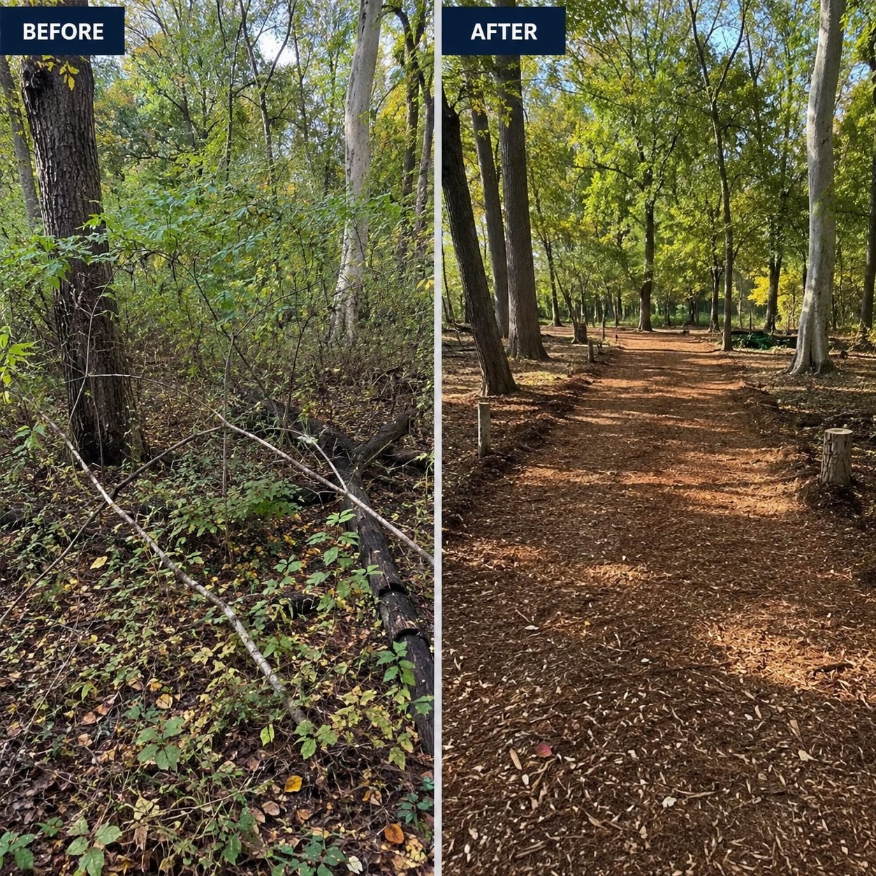
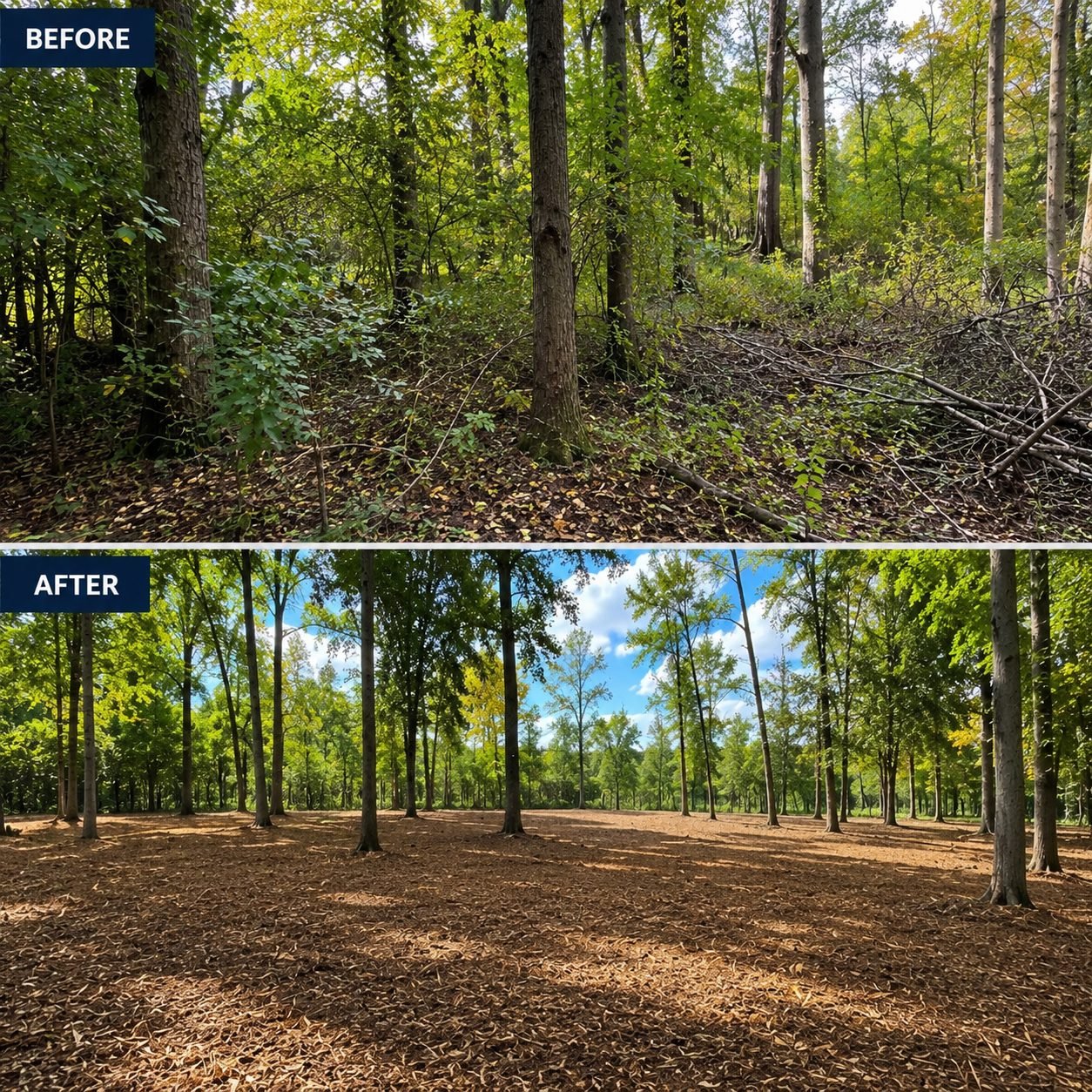
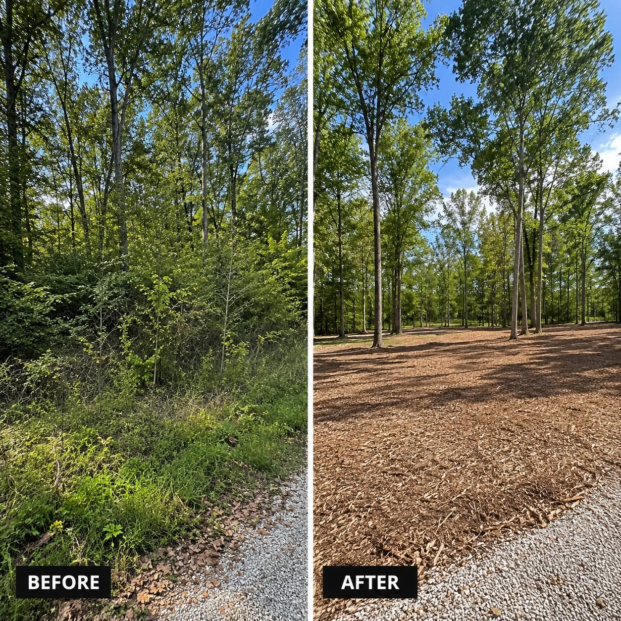
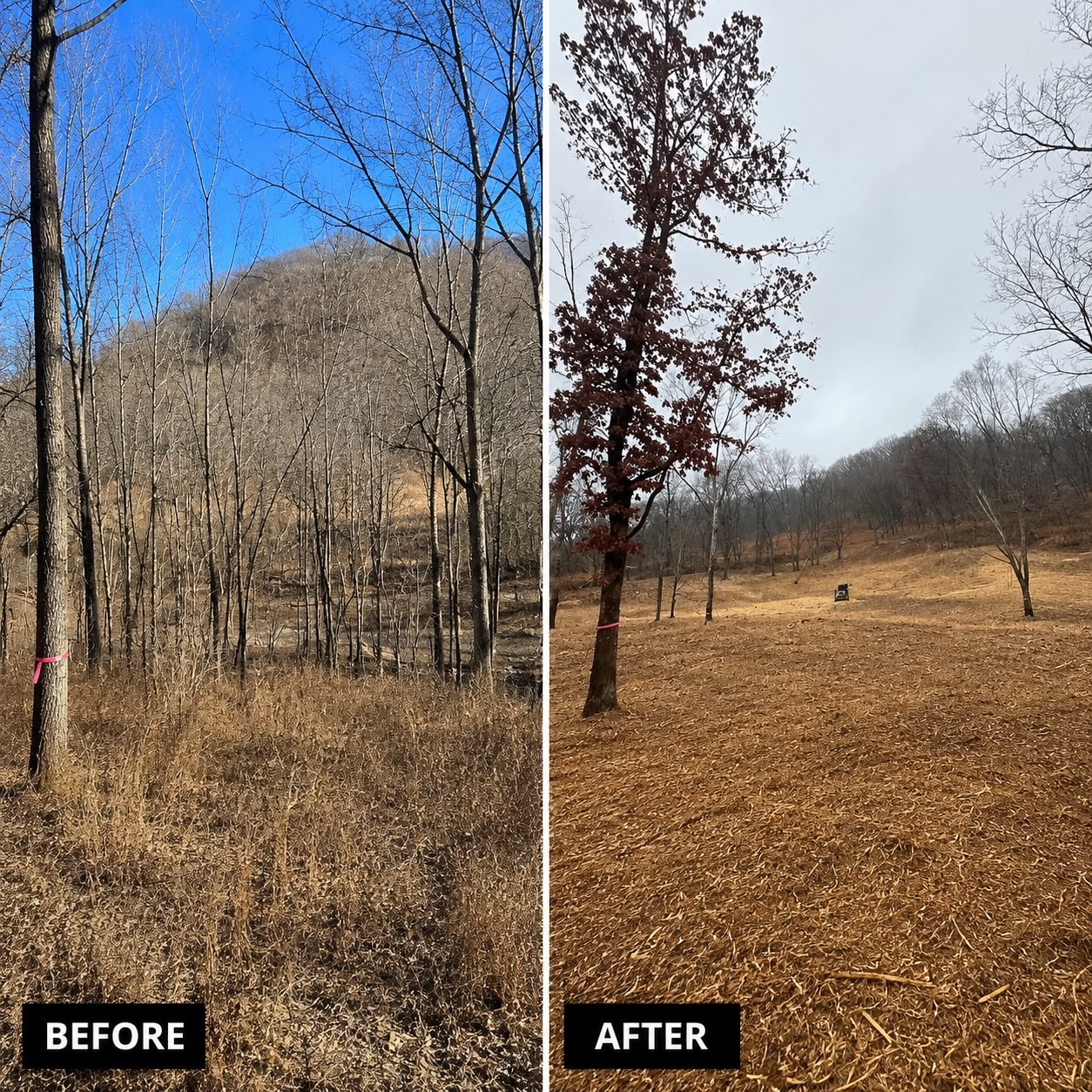
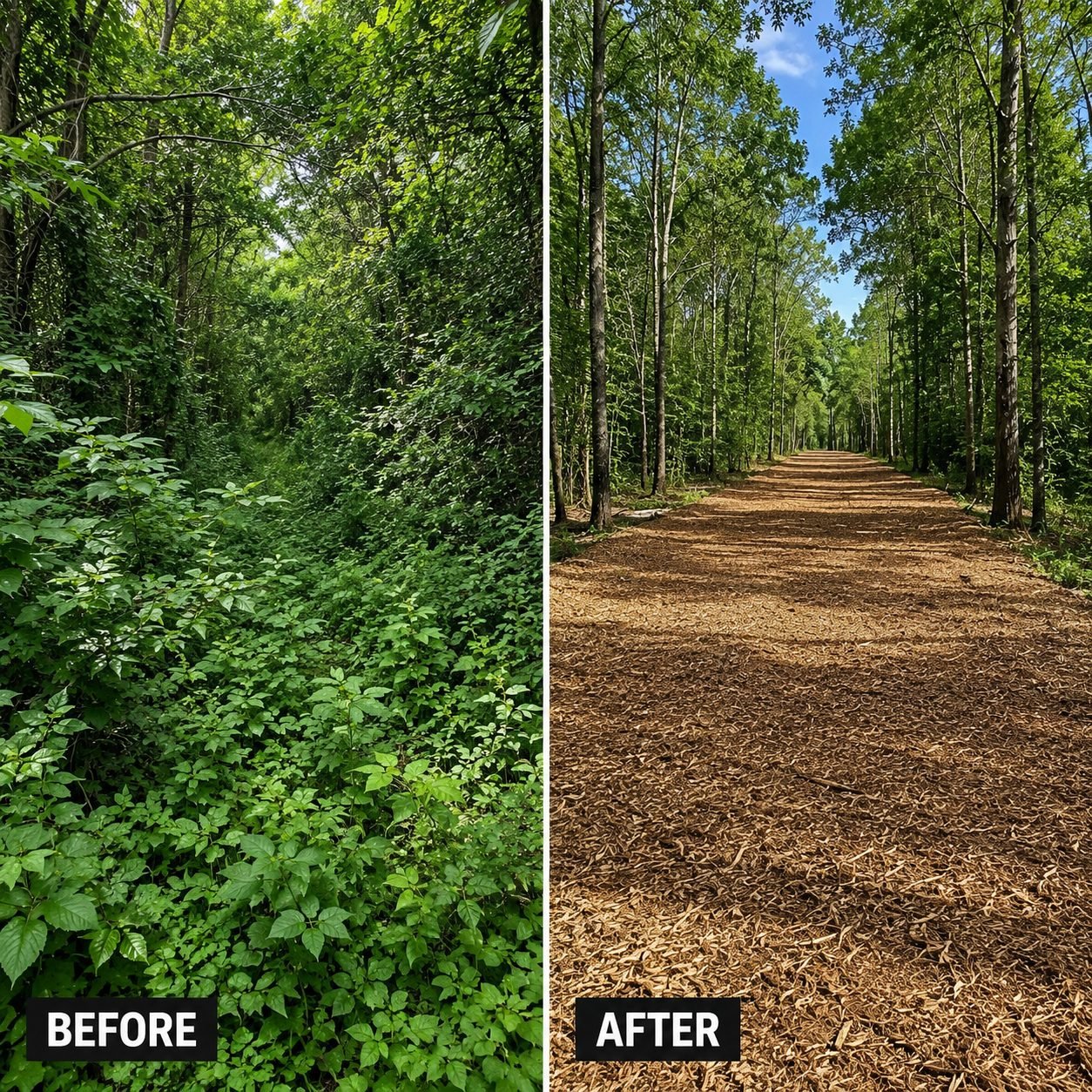
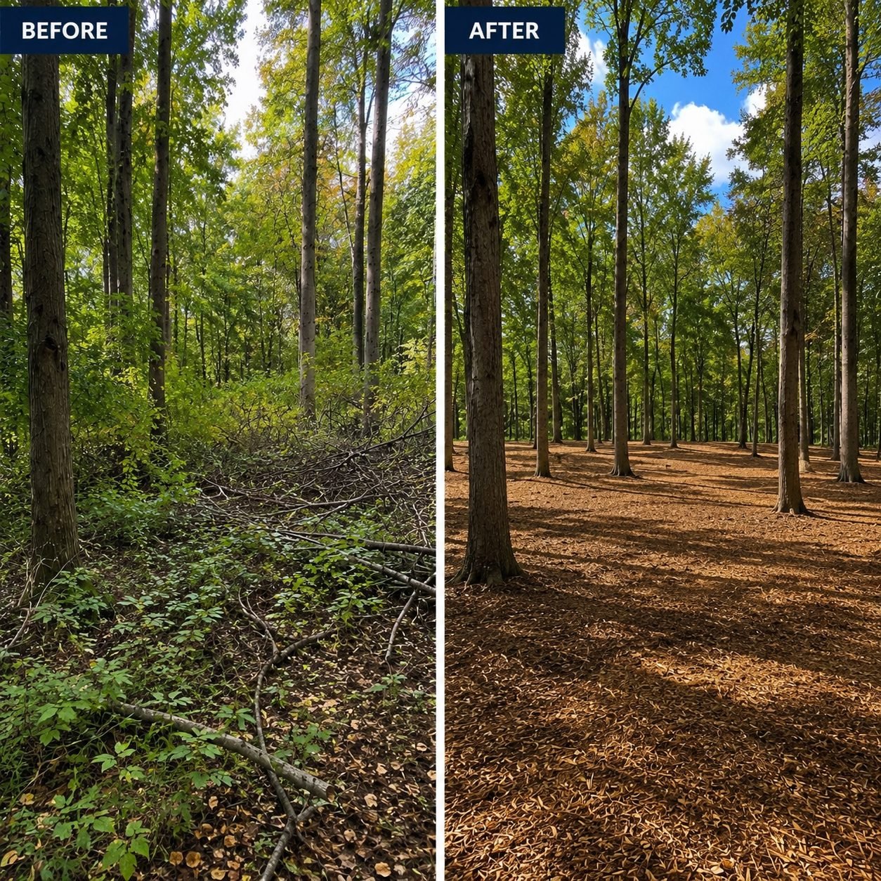
What Does Land Clearing Look Like Before and After in Galena, Ohio?
Recent Central Ohio jobs. The finished surface keeps a two to four inch mulch layer rather than bare soil, which is what holds ground through the first winter after clearing.
What Do Galena, Ohio Owners Ask About Land Clearing?
Usually the least restricted work, because it retains canopy and cover. It is still checked rather than assumed.
It is part of the walk rather than a separate stage. Any resulting permit runs two to six weeks.
Demolition permitting and utility disconnection, yes. Stormwater permitting sits with the owner or developer.
That is exactly the situation setbacks address. The parcel record settles what applies.
Narrow access through retained cover is a different question from clearing, and it is assessed individually.
No. Open burning is restricted here, which is why mulching on site is standard.
What Else Can Fortress Do on a Galena, Ohio Property?
Land clearing, forestry mulching, excavation, demolition and grading run with the same crew and the same point of contact, so a Galena job that needs two trades does not wait on a second schedule.
Demolition and asbestos notification requirements are administered by Ohio EPA Division of Air Pollution Control, and building requirements follow the code adopted through the Ohio Department of Commerce (both accessed August 2026). Soil depth, slope class and erosion factor for any Galena parcel are published in the USDA NRCS Web Soil Survey (accessed August 2026).
Ready for a Flat Rate on Your Galena, Ohio Land Clearing?
Owner-operated land clearing across all five Central Ohio counties. Send your property details and Lee gets back to you within 2 to 3 hours during business hours with one flat number after a free on-site walk-through.